


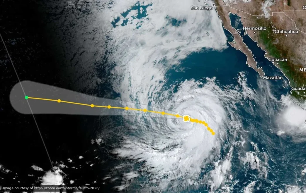
Hurricane Fausto officially became the first hurricane of the 2026 Pacific season late Monday night, strengthening to Category 1 with sustained winds at 120 kilometers per hour. The good news for Baja residents: it’s staying well offshore and moving away from Mexican territory.
As of Tuesday morning, the storm’s center was located roughly 1,260 kilometers southwest of Cabo San Lucas, tracking northwest at 19 kilometers per hour. No coastal areas are under watch or warning, and weather officials say the system is producing no effects on the Mexican mainland or peninsula.
Fausto Expected to Strengthen, Then Fade
The National Hurricane Center projects the storm will maintain its current intensity through Tuesday, then gradually strengthen into Wednesday and Thursday as it moves across open water. Forecasters expect Fausto to reach Category 2 strength by Wednesday evening, when it will be roughly 1,305 kilometers west of Punta San Lázaro.
After peaking mid-week, the storm is expected to begin weakening by the weekend as it continues tracking northwest, away from the coast. Hurricane-force winds currently extend 45 kilometers from the storm’s center, while tropical-storm-force winds reach out 260 kilometers.
Minor Coastal Effects Possible This Week
Although Fausto poses no direct threat, the storm is expected to generate increased swells along the western coast of the Baja California peninsula starting Tuesday night. The elevated surf and stronger currents could persist for a couple of days, though officials have not issued formal advisories.
For residents who remember last year’s Hurricane Hillary, Fausto is a very different story. Its distance and trajectory mean the storm will remain a tracking exercise rather than a preparation event.
What Residents Should Watch
Fausto’s central pressure stands at 987 millibars, and the system is moving at a steady clip that will keep it far from land through the rest of the week. Weather officials say the storm’s path takes it deeper into the eastern Pacific, with no indication it will curve back toward the coastline.
The Servicio Meteorológico Nacional has confirmed that no warnings or recommendations are in effect for any part of Baja California Sur or the mainland. Beachgoers should remain aware of changing surf conditions over the next few days, but the storm itself will stay well out to sea.