


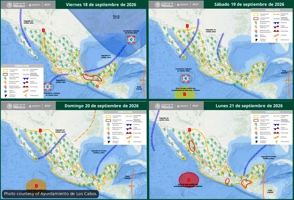
Los Cabos authorities issued a preventive weather alert this week as three low-pressure systems develop off Mexico’s Pacific coast, with one carrying an 80% chance of becoming a tropical cyclone.
The system most likely to strengthen is positioned south of Jalisco, Michoacán and Colima, and could move toward Los Cabos by Wednesday, September 23, according to Protección Civil de Los Cabos.
Francisco Cota Márquez, the municipality’s civil protection director, said current models suggest the system will track northwest before potentially turning north. It could pass near Cabo San Lucas or move into the Gulf of California toward Sinaloa.
What Conditions to Expect
Residents and visitors should prepare for heavy rain with lightning, strong wind gusts, high surf, flash flooding in arroyos and standing water in low-lying areas. Beaches across Los Cabos may be flagged red as waves increase, particularly if the system continues strengthening.
The forecast remains fluid as the system develops. Officials are working with Mexico’s National Weather Service and Conagua to track the storm’s path and will update the public as conditions change.
Safety Recommendations
Protección Civil is urging residents to secure outdoor furniture, avoid crossing flooded roads or arroyos, and follow only official information sources. The XV Ayuntamiento de Los Cabos emphasized that public safety remains the top priority as the systems evolve.
Two additional low-pressure zones are also being monitored but currently pose lower cyclone risk. Travelers planning beach days or water activities this week should check daily updates from municipal authorities and confirm conditions with hotel staff or tour operators before heading out.
The municipality will continue issuing timely advisories as the forecast becomes clearer over the coming days.
