


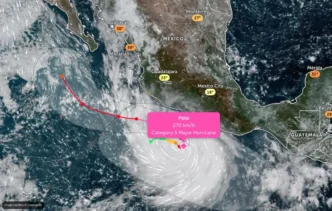
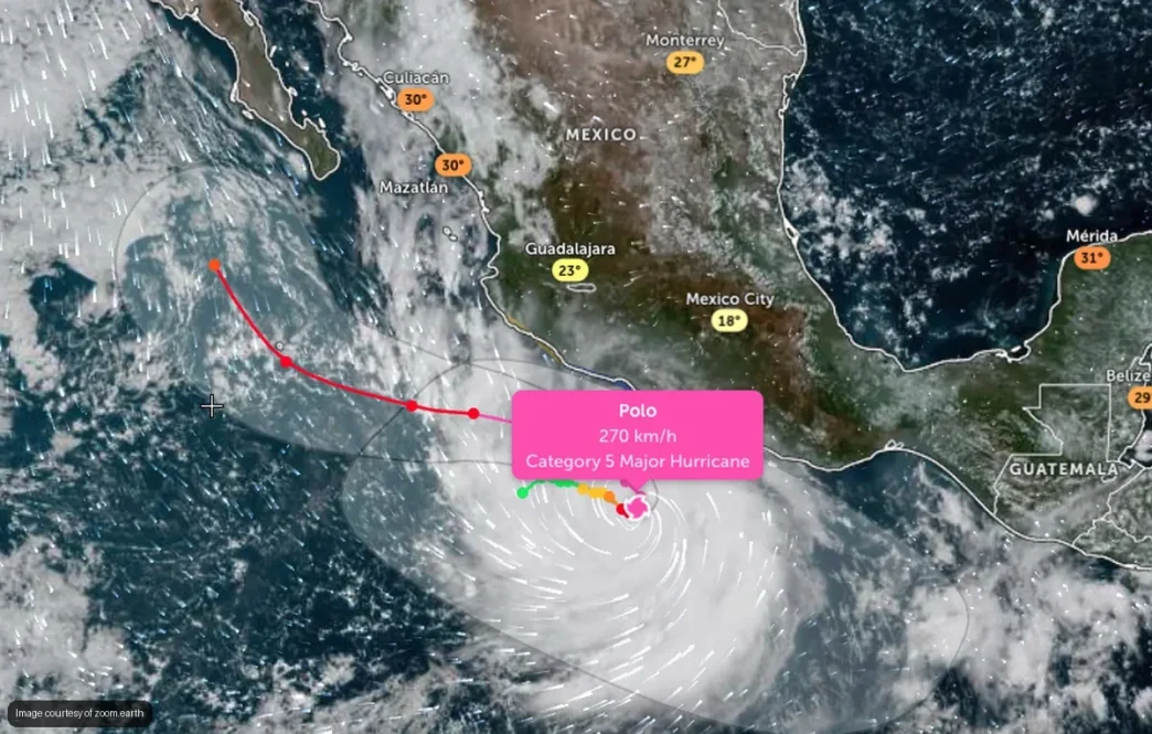
Hurricane Polo intensified to Category 5 early Tuesday morning, reaching the highest classification on the Saffir-Simpson scale with sustained winds of 260 km/h and gusts up to 315 km/h. The storm has undergone rapid intensification since forming as Tropical Storm Polo just days ago.
The center of the hurricane was located approximately 355 kilometers south-southwest of Zihuatanejo, Guerrero, and 580 kilometers south-southeast of Manzanillo, Colima, as of 06:00 hours Tuesday, according to Mexico’s National Meteorological Service (SMN) and the U.S. National Hurricane Center.
While Polo remains offshore and is forecast to stay over the Pacific, its wide circulation is already generating heavy rain, strong winds and dangerous surf across several states. The storm is moving east at 9 km/h, though forecasters expect a turn toward the northwest beginning Tuesday night.
What Los Cabos Officials Are Doing
The Los Cabos municipal government is maintaining permanent surveillance of the hurricane through its Dirección Municipal de Protección Civil y Gestión de Riesgos. Officials emphasize that Polo currently poses no direct threat to Los Cabos but are monitoring its evolution closely.
“At this time, the system does not represent direct impact to the municipality of Los Cabos,” the Ayuntamiento de Los Cabos stated in its most recent advisory. The municipality is issuing regular updates and urges residents to follow only official information channels.
President Claudia Sheinbaum reiterated Tuesday morning that current forecasts indicate Polo will not make landfall, though she called on residents in affected states to pay close attention to Protección Civil advisories.
Which States Face the Biggest Risk
Polo’s circulation is producing intense rainfall of 75 to 150 millimeters across portions of Guerrero, Oaxaca, Michoacán and Colima. Jalisco is seeing very heavy rain of 50 to 75 millimeters in southern and coastal zones.
Coastal areas of Michoacán and Guerrero are experiencing winds of 40 to 50 km/h with gusts reaching 60 to 80 km/h. Wave heights of three to four meters are forecast for those coastlines, with swells of two to three meters expected in Colima and Oaxaca.
The SMN and Conagua warn that heavy rain could trigger landslides, river flooding and dangerous conditions in low-lying areas. A tropical storm watch remains in effect from Tecpan de Galeana, Guerrero, to Manzanillo, Colima.
Polo’s Rapid Intensification
The storm has strengthened at an extraordinary pace. Polo became a Category 1 hurricane Monday afternoon, reached Category 2 by Monday night, jumped to Category 4 during the early hours of Tuesday, and hit Category 5 by 06:00 hours—all in less than 24 hours.
Forecasters had anticipated rapid strengthening due to favorable ocean temperatures and atmospheric conditions. Category 5 hurricanes feature sustained winds of at least 252 km/h, though the classification measures wind speed near the center and does not reflect the full geographic reach of rain, flooding or surf.
Polo is expected to remain a major hurricane—Category 3 or higher—through at least Thursday, according to Conagua’s extended outlook. The storm is then forecast to begin weakening as it continues moving over the Pacific.
What Residents Should Know
Even though Polo is not expected to make landfall, its effects extend hundreds of kilometers from the center. Rain bands, wind and dangerous surf can reach coastal areas well away from the eye of the storm.
The Coordinación Nacional de Protección Civil advises residents near bodies of water to monitor water levels, locate the nearest emergency shelter and prepare an emergency kit. Classes have been suspended in Guerrero and Michoacán through at least Wednesday.
Navigation has been restricted at several Pacific ports, and the Mexican Navy has activated preventive protocols under Plan Marina. The military is also deploying emergency response teams in Jalisco, Colima, Guerrero and Michoacán.
Los Cabos residents should continue following updates from local Protección Civil authorities. While the municipality is not currently under threat, forecasters caution that hurricane tracks can shift and that residents across Baja California Sur should remain informed.
A Reminder of Otis
The rapid intensification of Polo has drawn comparisons to Hurricane Otis, the last Category 5 storm to impact Mexico. Otis struck Guerrero in 2023, causing nearly 70 deaths and widespread destruction in Acapulco after strengthening unexpectedly just before landfall.
Forecasters stress that while Polo’s current track keeps it offshore, the storm’s intensity and the potential for shifts in direction mean coastal communities must stay vigilant. The National Hurricane Center describes Polo as “extremely dangerous.”
Updates on the storm’s position, intensity and forecast track are issued every six hours by the SMN and the National Hurricane Center. Residents in watch zones should not assume the hurricane will remain over open water and should prepare accordingly.
