


Los Cabos residents and weekend visitors should prepare for heavy rain and rough seas over the next four days, according to Protección Civil. The municipal agency is monitoring a weather system expected to bring up to 150 millimeters of precipitation, winds gusting to 60 kilometers per hour (37 mph), and waves reaching 2.5 meters (8 feet) through Monday.
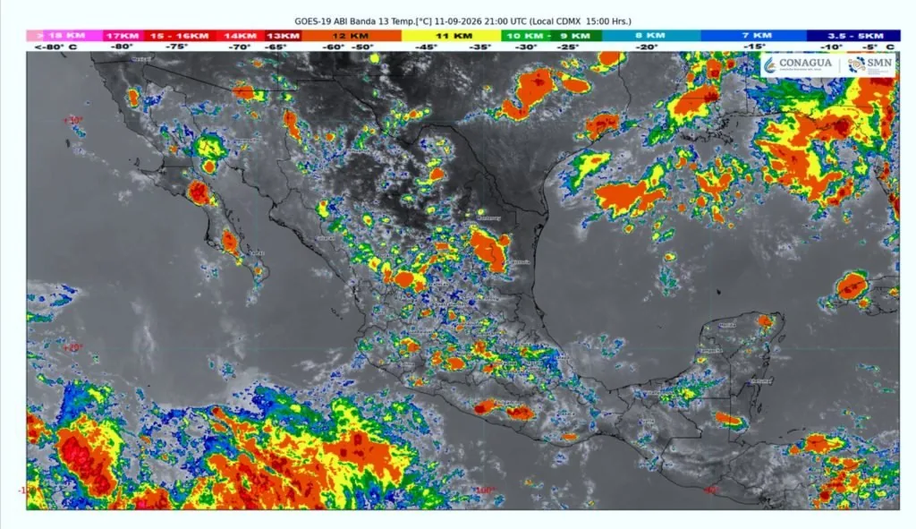
Officials say the storms result from the interaction of the Mexican monsoon, upper-level divergence, low-pressure channels, and a mid-level trough. The municipality of Los Cabos is coordinating with federal agencies to safeguard residents as the system moves through southern Baja California Sur.
What to Expect Each Day
Friday, September 11: Heavy to locally intense rain is forecast, with totals between 75 and 150 millimeters (3 to 6 inches). Wind gusts may reach 40 to 60 km/h, and wave heights are expected at 1.5 to 2.5 meters. Lightning, hail, and localized flooding are possible.
Saturday, September 12: Heavy rain with very strong bursts of 50 to 75 millimeters (2 to 3 inches) is expected. Conditions should begin improving by evening.
Sunday, September 13: Scattered showers bringing 5 to 25 millimeters (up to 1 inch) are likely, with decreasing intensity.
Monday, September 14: Very heavy to intense rain returns, with totals again reaching 75 to 150 millimeters. Wind gusts may hit 60 km/h, and waves could reach 2.5 meters. This marks the second major round of precipitation.
Tuesday, September 15: Showers taper off with 25 to 50 millimeters (1 to 2 inches) expected. Pacific swells may generate waves of 1 to 2 meters along the coast.
Which Areas Are Most at Risk
Protección Civil warns that arroyos and low-lying zones are especially vulnerable to flooding and fast-moving water. Residents and tourists should avoid crossing arroyos even when water appears shallow—flash flooding can occur with little warning during heavy rain.
River and arroyo levels are expected to rise significantly, and mudslides are possible in hillside areas. Authorities also caution against leaving trash or debris near drainage channels, as blockages can worsen flooding in urban neighborhoods.
Beach Safety and Red Flags
Wave heights of up to 2.5 meters present serious risks for swimmers and beachgoers. Red flags are expected at several beaches throughout the weekend, and the Capitanía de Puerto may issue additional advisories for boaters.
Visitors planning beach activities should check daily updates from Protección Civil and heed warnings from lifeguards. Strong currents and undertow can develop quickly when swells are elevated, even on beaches that normally appear calm.
What Residents Should Do Now
The municipality urges residents to secure outdoor furniture, potted plants, and any objects that could be blown by wind. Drivers should plan extra time for travel and avoid attempting to cross flooded roadways or arroyos.
Stay informed through official channels rather than social media rumors. The municipal government will issue updates as conditions change. If you’re visiting Los Cabos this weekend, expect delays, possible road closures, and limited outdoor activities until conditions improve Tuesday.
No Tropical Threat
While Tropical Storm Norbert is currently active in the Pacific, the system is moving away from Baja California Sur and poses no direct threat to Los Cabos. Norbert is located more than 1,850 kilometers west-southwest of Cabo San Lucas and is forecast to become a hurricane over open water this weekend before weakening early next week.
The rain expected in Los Cabos is unrelated to Norbert and stems from separate atmospheric conditions over the southern peninsula.
